Hey there. We wanted to offer a variety of imagery that is used to track hurricanes. We don't have any analysis about Katrina specifically. All of the news networks are covering that information with many more resources than we have. If you are located in any of the areas along any hurricane storm track, please make sure you are prepared. For more information about hurricanes and other natural disasters, check out these links.
- FEMA Home Page
- National Hurricane Center - Atlantic (NOAA)

- Learn about Natural Disasters (Kids) (FEMA)
- Kids Talk About Disasters (FEMA)
- Disaster Action Kids (FEMA)
- What You Might Feel (Kids) (FEMA)
- Activities for Kids (FEMA)


TROPICAL WEATHER FORECAST (72 HOURS)

Caribbean Sea Forecast
This image, provided by NOAA, is updated once a day with the forecast for the Western Atlantic and Caribbean Sea. The 72-hour forecast tries to predict the direction and location of low pressure systems and storms. That means this image shows the expected/predicted location of storms three days from now. This surface forecast gives you a good idea where low pressure systems move across the sea. These low pressure systems and storms begin in Africa, move across the Atlantic Ocean and take a variety of paths when they reach the waters off of North America.

Link: TAFB Atlantic Forecasts (NOAA)

GOES Satellite 
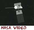
New GOES-N Satellite
The spacecraft is the first in a new series of weather satellites serving as our "eyes in the sky." (NASA/KSC)
- View Video (Real-cc)

GOES Satellite Weather Views
From 22,000 miles up, GOES satellites have a sky-high view of the weather below. (NASA/KSC)
- View Video (Real-cc)

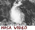
CARIBBEAN WATER VAPOR PATTERNS

GOES Satellite Image
Weather and storms across the world constantly affect our daily lives. As technology has improved, scientists have placed satellites in orbit around the world to monitor changing weather patterns. In this example, the Geostationary Operational Environmental Satellites (GOES) operated by NOAA reflect different ways of viewing the Earth and its atmosphere. GOES views include visible, infrared, water vapor channel (seen here), and other views to monitor weather systems around North America. This image is excellent to view how water vapor in constantly swirling around the globe.

During the summer months you can see the hurricanes forming off the east coast of Florida. The tropical storms and hurricanes appear as large swirls of white. You will also be able to see large storms forming off the west coast of Mexico in the Pacific Ocean.

This image displays the water vapor channel data delivered from GOES satellites orbiting the Earth. The image is updated every three hours. You may view the page sponsored by National Oceanic and Atmospheric Administration (NOAA) at http://www.goes.noaa.gov/goesfull.html.

Link: GOES Satellite Imagery (NOAA/GOES)

World Temperature Map Looking at Hurricanes
Hurricanes provide unusual opportunities for scientific reasearch. NASA regularly looks at hurricanes and develops forecasting models to study the storms. (NASA/GSFC)
- View Video (Flash-cc)

Satellite Imaging Earth Birth of a Hurricane
Learn how NASA and NOAA scientists studied and tracked hurricane Isabel from her birthplace in Ethiopia. (NASA/GSFC)
- View Video (Flash-cc)


SATELLITE IMAGES (EAST HURRICANE SECTOR)

GOES Satellite Image
This visible light image, provided by the National Oceanic and Atmospheric Administration, is updated regularly with current conditions from the Caribbean and Western Atlantic Ocean. The image shows current hurricanes and developing ones in the ocean. The image updates about once every 30 minutes. Since this is a picture taken in visible light, you won't see any of the clouds during the night. Once daylight starts to cross the Atlantic Ocean, the clouds will appear to the satellite again.

Link: GOES Satellite Imagery (NOAA/GOES)

Satellite in Orbit studying hurricanes 
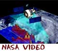
Hurricane Watch from Space
Learn how the many instruments designed by NASA are in orbit around the globe and studying hurricanes. (NASA/JPL-12MB)
- View Video (QT-cc)

Polar image of Earth Warming Earth?
Is the temperature of the Earth rising? Are these global temperature changes adding to the force of hurricanes? (NASA/KSC)
- View Video (Real)


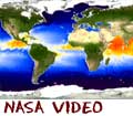
OCEAN SURFACE TEMPERATURE

Ocean Analysis of Sea Surface Temperature
As hurricanes move west across the Atlantic, they grow stronger in warm water. Scientists monitor the ocean temperatures and have discovered some of the strongest hurricanes are created in water that is a higher temperature than normal. This real-time global sea surface temperature (SST) analysis has been developed by Richard Reynolds from the Environmental Modeling Center of the National Centers for Environmental Prediction (NCEP).

Link: Environmental Modeling Center (NOAA/NWS/NCEP)
Link: National Center for Environmental Prediction (NOAA/NWS/NCEP)


Link to Cosmos4Kids.com Link to Biology4Kids.com Link to Chem4Kids.com Link to Geography4Kids.com Link to Physics4Kids.com Link to NumberNut.com Rader Network Side Navigation

Related Links
- Geography4Kids: Atm. Interaction
- Chem4Kids: Gases
- Chem4Kids: Evaporation
- Chem4Kids: Environmental Chemistry
- Biology4Kids: Birds
- Cosmos4Kids: Earth
- Cosmos4Kids: Mars
- Physics4Kids: Heat

- NASA: Kennedy Space Center
- NASA: Goddard Spaceflight Center

RETURN TO TOP
or
Search for more information...

* The custom search only looks at Rader's sites.

Geography4Kids Sections

Rader's Network of Science and Math Sites